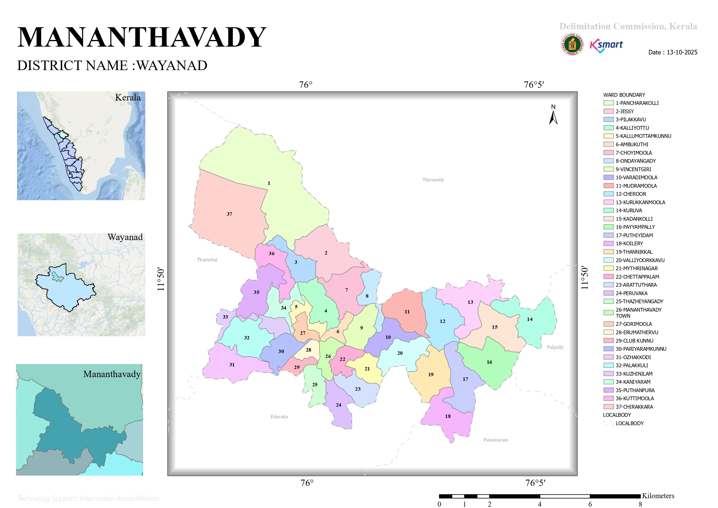
Mananthavady Municipality is located in the northern part of Wayanad district in Kerala, on the Wayanad plateau of the Western Ghats. It serves as an important administrative and commercial center of North Wayanad.
Location
- District: Wayanad, Kerala
- Latitude & Longitude: Approximately 11.8° N, 76.0° E
- Elevation: About 760 meters above mean sea level
- Distance from Kalpetta: Around 35 km northeast
- Distance from Kozhikode: Around 110 km northeast
Area
- Municipal Area: Approximately 80.1 sq. km.
Boundaries
The municipality is bounded by:
- North: Tirunelli Panchayat
- West: Thavinhal Panchayat
- East: Kabini River
South: Kabini River and adjoining areas
Mananthavady Municipality is a geographically extensive local urban body situated in the northern region of Wayanad District. The municipality comprises 37 wards spread across a diverse landscape of river valleys, agricultural lands, forest fringes and urban settlements. The Kabani River forms a major natural boundary and water resource, while its location on the Wayanad Plateau of the Western Ghats provides ecological significance and strategic connectivity to Karnataka and other parts of Kerala. Mananthavady functions as the principal administrative, commercial and service centre of North Wayanad.
Key Geographic Strengths
- Large municipal area (about 80 km²).
- Presence of the Kabani River system.
- Strategic location within North Wayanad.
- Strong agricultural base.
- Forest and biodiversity resources.
- Regional transport connectivity.
- Combination of urban and rural landscapes.